


Tour des Six : stage 1 / 3 - Gressoney
Gressoney-Saint-Jean › Colle di Vanera › Arp hut
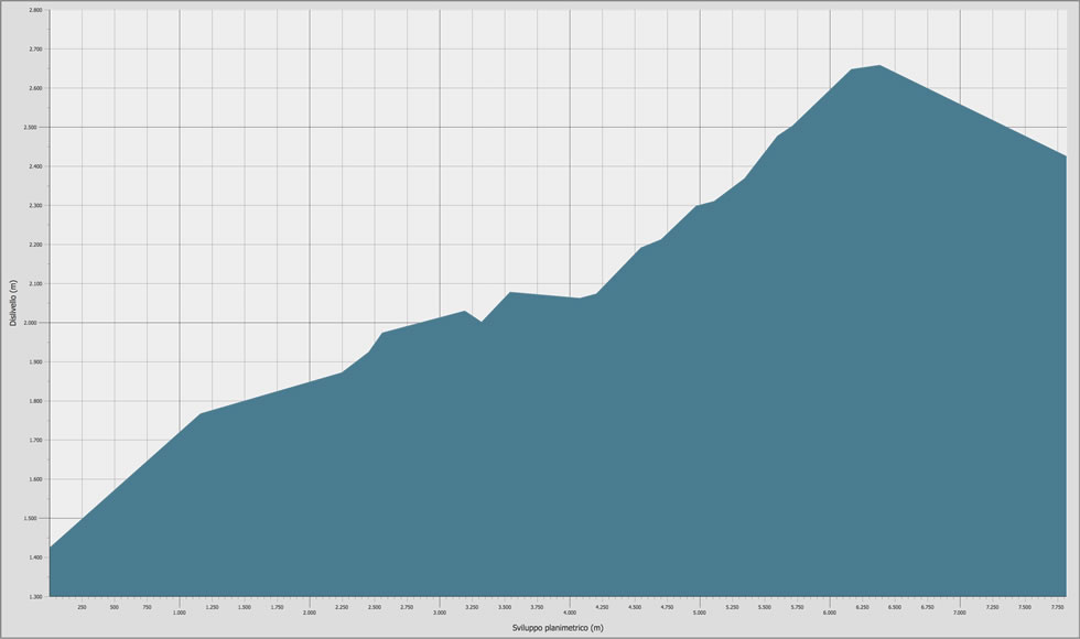
Stage duration, distance and elevation gain
| DEPARTURE | ALTITUDE | ARRIVAL | ALTITUDE | TIME | DISTANCE | POSITIVE ELEVATION GAIN | DIFFICULTY |
|---|---|---|---|---|---|---|---|
| Gressoney-Saint-Jean | 1.423 m | Rifugio Alpenzu | 1.780 m | 01.04 | 1.234 m | 355 m | E |
| Rifugio Alpenzu | 1.780 m | Col Valnera | 2.675 m | 03.00 | 5.396 m | 976 m | E - EE |
| Col Valnera | 2.675 m | Rifugio Arp | 2.446 m | 00.30 | 1.568 m | / | E |
| TOTAL | 04.34 | 8.198 m | 1.331 m | E | |||
All the technical data on this site (kml and gpx tracks, chart data and topographic profile) were taken from the Autonomous Region of Valle d'Aosta Register of Footpaths.
Official website: http://geonavsct.partout.it/pub/geosentieri/
Altimetry

Area download : Tour des Six tracks for your GPS

The route
- Book now
- send us an email
- tel. +39 348 52 04 316