


Tour des Six: stage 3 / 7
Grand Tournalin hut › Col di Nana › Cheneil › L'Emitage hut
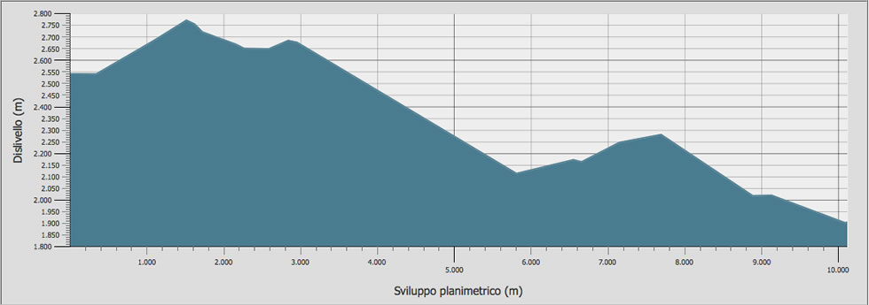
Stage duration, distance and elevation gain
| DEPARTURE | ALTITUDE | ARRIVAL | ALTITUDE | TIME | DISTANCE | POSITIVE ELEVATION GAIN | DIFFICULTY |
|---|---|---|---|---|---|---|---|
| Rifugio Gran Tournalin | 2.544 m | Col di Nana | 2.694 m | 01.09 | 2.903 m | 305 m | T - E |
| Col di Nana | 2.694 m | Cheneil | 2.105 m | 01.05 | 2.980 m | / | E |
| Cheneil | 2.105 m | Rifugio Ermitage | 1.927 m | 01.28 | 4.250 m | 195 m | T - E |
| TOTAL | 03.42 | 10.133 m | 500 m | E | |||
All the technical data on this site (kml and gpx tracks, chart data and topographic profile) were taken from the Autonomous Region of Valle d'Aosta Register of Footpaths.
Official website: http://geonavsct.partout.it/pub/geosentieri/
Altimetry

Area download : Tour des Six tracks for your GPS
 Download the route of the stage in gpx format [ 53,50 kb ]
Download topographic profile of stage 3/7 Tour des Six [ 33,91 kb ]
The route
- Book now
- send us an email
- tel. +39 348 52 04 316