


Tour des Six: stage 2 / 7
rifugio Ferraro › Saint-Jacques - Grand Tournalin hut
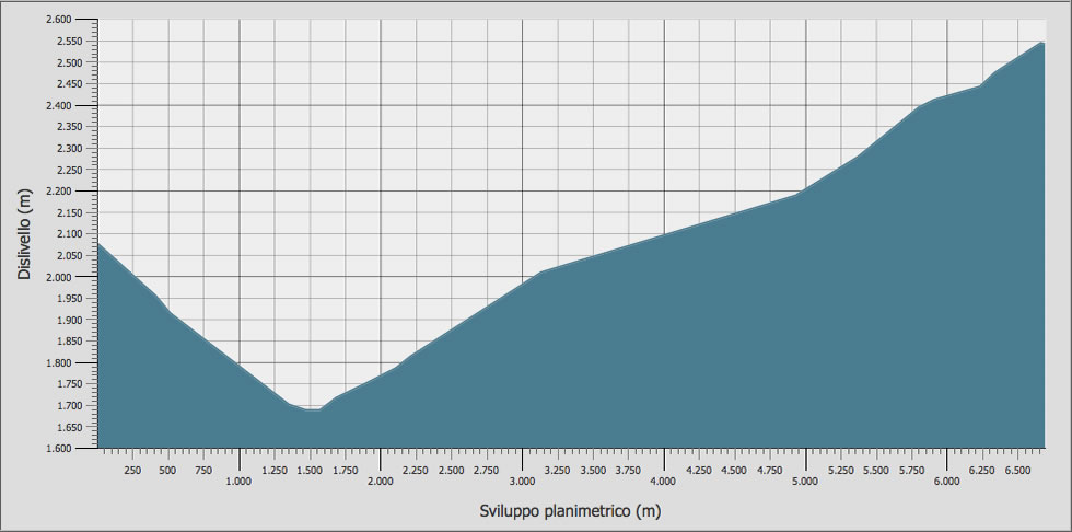
Stage duration, distance and elevation gain
| DEPARTURE | ALTITUDE | ARRIVAL | ALTITUDE | TIME | DISTANCE | POSITIVE ELEVATION GAIN | DIFFICULTY |
|---|---|---|---|---|---|---|---|
| Résy Rifugio Ferraro | 2.078 m | Saint-Jacques | 1.690 m | 00.47 | 1.596 m | / | T - E |
| Saint-Jacques | 1.690 m | Nanaz | 2.040 m | 01.02 | 1.808 m | 350 m | E |
| Nanaz | 2.040 m | Rifugio Gran Tournalin | 2.544 m | 01.34 | 3.331 m | 504 m | T - E |
| TOTAL | 03.23 | 6.735 m | 854 m | E | |||
All the technical data on this site (kml and gpx tracks, chart data and topographic profile) were taken from the Autonomous Region of Valle d'Aosta Register of Footpaths.
Official website: http://geonavsct.partout.it/pub/geosentieri/
Altimetry

Area download : Tour des Six tracks for your GPS
 Download the route of the stage in gpx format [ 377,03 kb ]
Download topographic profile of stage 2/7 Tour des Six [ 55,93 kb ]
The route
- Book now
- send us an email
- tel. +39 348 52 04 316